

We can’t change the weather, but we can know what to expect thanks to Jake the Weather Guy
After a life of growing up in Kenosha, Jake Hoey went west and graduated from the University of Oklahoma where he said that, “The School of Meteorology there is widely seen as one of the best in the country and it houses the National Weather Center on campus.”
During his time in Oklahoma, Jake and his colleagues chased after dozens of storms in the area. But he hung up his storm-chasing days when he returned to Kenosha after graduation in 2013, but not his love for looking at the skies and predicting what will come.
In October 2013 Jake started his Facebook weather page titled, Jake’s Kenosha Area Weather Page. “I had several goals in mind,” he said in a previous interview with The Smart Reader. “The most important was to fill the gap in weather information here in Kenosha. We obviously sit between two large cities that each have many sources of weather information that include us, but they do tend to focus more on their own weather.”
Now, you can find Jake’s 7-day forecast every Thursday on his Facebook page, as well as updating posts whenever it looks like a storm or other weather event is on the horizon.
In the past eight years since launching his page, freelance meteorologist Jake Hoey, aka Jake the Weather Guy, has been building a strong following with his insightful weather forecasts – specific to our area, and we were lucky to have him join us for this exclusive Q&A.
Q. After reading the new climate study published in the Journal Science should we have serious concerns?
A. Climate change continues to be one of the most pressing issues that humanity is facing in the 21st century. This study describes some specific consequences for the European continent, namely worsening drought. This is a great concern given the impact drought has on society and the economy. So, yes, this is a concerning study for us and another example of the wide-reaching effects of climate change.
Q. What about the drought we are experiencing in our country in the west and southwest, is that showing any signs of abating?
A. Over the past month there has been some limited improvement in some locations. Utah, the Las Vegas area, and the Four Corners have seen a slight decrease in drought classification, but still remain in a quite major drought. Most of California, Oregon, and Washington have seen little change. Parts of Idaho and Montana have exhibited some worsening of the drought so the overall west/southwest region has very similar drought conditions compared to a month ago. The longer term trend, since early summer, has been for improvement in the south (Arizona and New Mexico) and worsening in the north (Oregon, Washington, Idaho, and Montana).
Q. We have been told that July 2021 has been recorded as the hottest month ever, since weather records began, how far back do they go?
A. Yes, the July average global surface temperature broke the previous monthly record by 0.1°C. The previous record was a three way tie between 2016,2019, and 2020. Since July is Earth’s hottest month, this makes July 2021 the hottest month on record, globally. The record dates back to 1880 which is 142 years of data.
Q. In your opinion could this go down as the warmest year ever?
A. The global surface temperature anomaly for 2021 is expected to end up in the top 10 hottest year on record. Unless there is a very hot 2021 finale for the planet, this will probably not end up contending for the hottest year on record given the relatively cooler (though still above normal) winter months that began the year.
Q. If the year 2021 finishes as one of the 10 hottest years on record and based on this climate study issued earlier this month in the journal Science, should that give us even further concern for an increased risk for extreme winter weather and prolonged cold spells in the Midwest?
A. As the study shows, there is a link between temperature gradient in the arctic and the stability of the polar vortex. This means that the rate of arctic warming compared to the rate of sub-arctic warming is very important for our winter weather here. Both locations are warming, this we know, but the most troubling aspect is the faster rate of warming in the arctic compared to lower latitudes. So it does stand to reason that our warming climate is leading to decreased polar vortex stability, however “across the board” warming is less of the culprit than faster arctic warming. So the global annual average surface temperature can’t really tell us if that factor specifically is happening more so this year than in years past.
 Q. We hear of these 100 year storms or events that now seem to happen with regularity, just what is the definition of a 100 year storm?
A. The phrase “100 year storm” is an attempt to contextualize the probability of a weather event. It means there is a 1% (or 1 in 100) chance of that event happening in a given year. So it is possible that two “100 year storms” can happen in the same year or even the same week. It is just a very unlikely occurrence.
Q. Do you think the cold spell that happened in Texas was an aberration or possibly the beginning of a trend? In your opinion, is this recent climate study published in the journal Science correct in their assumptions that a warming Arctic and a stretched vortex was responsible for the prolonged deadly Texas cold spell?
A. The winter storm and record cold temperatures of last February in Texas was certainly an extreme and unusual weather event. By the very nature of extreme weather, these events are not anticipated with high frequency, however the study does highlight the increased likelihood of stratospheric polar vortex breakdown. This is due to a decrease in temperature gradient between arctic and sub-arctic regions because of faster warming in the arctic. So we can’t say that there will be more events like the one in Texas, but the opportunity for them seems to be increasing. Yes, the Texas cold event was a result of a stretched polar vortex. The vortex is often poorly understood outside of academia and it doesn’t so much move and “come down here” so to speak. Really what happens is the boundary becomes more wavy and those waves are better able to stretch farther south and cause intrusions of arctic air in mid latitudes. Events like this have been happening for centuries but, as the study shows, they could be increasing in frequency due to climate change.

Q. Could Texas be in store for more extreme weather events such as the prolonged cols spell?
A. Given the current observed rate of climate change and the limited global response in decreasing carbon emissions, it appears likely that the consequences of climate change will continue to be felt for decades to come. It’s impossible to say that that exact weather phenomenon, the extreme cold in Texas last winter, will repeat itself. However, extreme weather of its ilk could very well recur and we will be left to deal with the repercussions.
Q. Closer to home, here in Southeastern Wisconsin could we possibly see an uptick in severe weather events such as tornados here in the months and years to come?
A. Air of a higher temperature is able to hold more moisture. Moisture is a key component for severe weather formation so, broadly speaking, hotter temperatures are more conducive for severe weather formation. This is particularly impactful when the hotter air is in the lower atmosphere (troposphere) and near the surface. We can’t just say that there will be more tornadoes here because of climate change, but hotter surface air temperatures could aid in longer storm seasons and more opportunity for tornado formation among many other consequences.
 Q. This winter, what does the long range forecast look like for our area here in Southeastern Wisconsin?
A. A common tool used to produce seasonal outlooks, especially for winters in North America, is the El Niño-Southern Oscillation (ENSO). The current ENSO phase is neutral (neither El Niño nor La Niña). However the Climate Prediction Center currently predicts a 70 to 80% chance of La Niña forming for this coming winter. As such, their outlook favors the opportunity for above normal precipitation in this region. The signal for temperature is less strong and currently they are showing slightly above normal temperatures here. So there is evidence that this could be a snowy winter for the Kenosha area, but warmer temperatures could be a factor as well.
For all your local weather updates follow Jake’s Kenosha Area Weather Page
Check out some of Jake’s past BLOGS
Previous Q&A’s w/ Jake here
Support Kenosha’s best local weather guy becoming a Patreon Subscriber
Listen & learn more about Jake and his love for meteorology Here
Q&A by Frank Carmichael
Edited by Jason Hedman
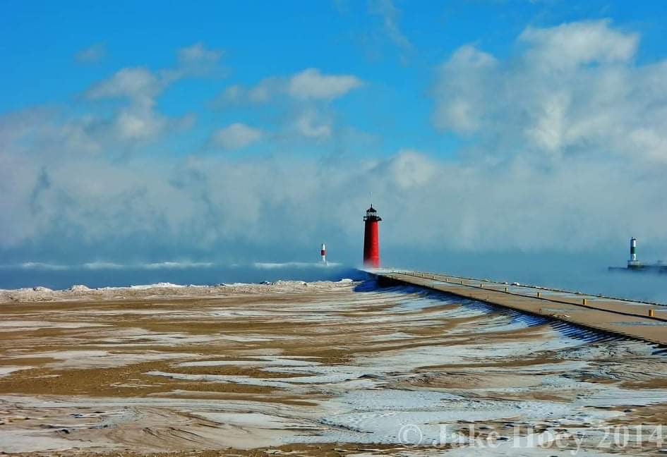
Photo submitted by Jake Hoey
Follow Happenings Magazine on Facebook HERE